
Road-tracking platform Wandrer has launched an official iOS app and a dedicated Garmin Edge app and data field, alongside two new route-planning tools aimed at walkers, runners and cyclists.
The update also adds a new exploration metric, support for tunnels, Catalan localisation and EuroVelo trails. Wandrer says every new feature was built in response to requests from its global community.
Garmin Edge: live map data from the cloud
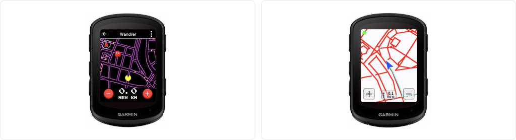
The headline addition is the Wandrer Garmin App and Data Field for Edge cycling computers. It replaces the old multi-step process of generating, downloading and transferring large map files to a device via a computer. Instead, the data field pulls a rider’s personal Wandrer map from the cloud and calculates new road coverage in real time during an activity.
It also introduces “Arcade Mode”, a gamified approach to collecting untravelled roads on the go.
iOS app records activities and shows progress live
The Wandrer iOS app, which will soon be available for Android, records bike and foot activities and shows new road progress in real time, both on the map and as a total, as well as progress in the areas the user is travelling through. Wandrer says the app will soon let users apply its routing features to travel to a destination while maximising new roads along the way.
New routing tools
Point-to-point routing lets users plan a route from A to B while maximising untravelled roads. Riders specify how much extra distance they are willing to cover and the tool offers several options.
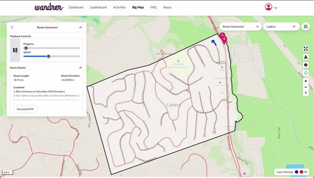
The “100%” routing tool, also known as “Every Road in an Area”, lets users draw a shape on the map, set start and end points, and generate a route covering every road within it. There are options to exclude dead-ends and unpaved roads. Wandrer pitches it as a way to “knock out an entire neighbourhood at once”.
“Biggest Blob” metric
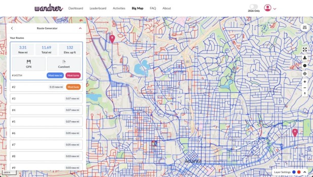
Wandrer’s take on classic “tile hunting”, the Biggest Blob challenges users to build their largest continuous network of interconnected roads, rather than completing a traditional neighbourhood or city boundary. A built-in tolerance allows gaps of up to 100 metres so minor mapping anomalies or inaccessible segments don’t break progress.
The feature is already generating engagement on Reddit, with users heading into unfamiliar territory to link disconnected paths.
Wandrer founder Craig Durkin said: “Our community is the ultimate engine behind everything we build, and these features are a direct reflection of their real-world tracking needs. Whether it’s bringing the map directly to a Garmin Edge device on the handlebars or launching the new iOS app, these updates exist because our users asked for them.
“We’re especially excited about the ‘Biggest Blob’ feature. Wandrer has always been about encouraging people to ride and run in new places. While we’ve historically focused on helping folks check off entire towns or cities, this new metric rewards connection. It has been incredible to see users heading out to connect random, orphaned bits of their map – biking just a few miles to bridge a gap and watching their main continuous blob instantly grow by 20 miles. We are incredibly grateful to our community for pushing the platform forward.”
What else is new?
- Single entry/exit tunnel credit
- EuroVelo bike trails and extra long-distance routes
- Activity search by name
- Year-only mode, currently covering 2026 activities only
- Catalan localisation