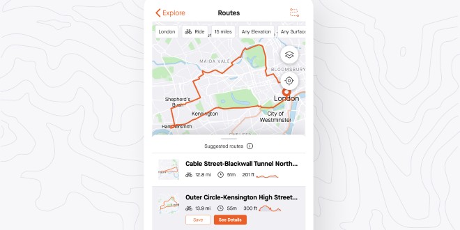
Strava has unveiled Routes, a new tool to help athletes find the best places to run and ride.
“With over three billion activities uploaded from all over the world, Strava knows where athletes actually run and ride,” said a statement. “Routes uses that knowledge to provide high-quality route recommendations personalised to athletes’ preferences for location, distance, surface type (pavement or dirt) and hilly or flat terrain.”
Terrain surface type is powered by OpenStreetMap, the “world’s largest” open-source map dataset, and enriched with data from the Strava community including the types of bike frames that have travelled on a given segment.
Additional features include:
– Time estimates based on recent activity pace, personalised for every athlete
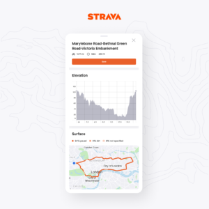
– Details screen showing elevation and surface changes
– Optional Heatmap overlay to see popularity on any particular section of a route