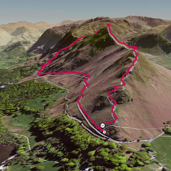
Ordnance Survey has released Aerial 3D, a desktop and mobile viewing tool that meshes with 750,000 publicly shared routes, including thousands of professional routes published by walking, cycling and mountaineering publications and organisations.
In Aerial 3D, the routes can be viewed from all heights and angles.
Ordnance Survey Leisure MD Nick Giles said: “The introduction of the Aerial 3D viewing tool is another major step in making the outside enjoyable, accessible and safe for all. The new feature is perfect for anyone thinking of hiking, biking or climbing in Britain. It helps them to plan in accordance with their skills and experience. And importantly, being able to see routes clearly in this way should help people get inspired to do more in the great outdoors and at the same time keep safe.
Existing subscribers to OS Maps will be able to start using Aerial 3D immediately. For non-subscribers there’s a seven-day free trial.